CartoMobile® is no longer available
CartoMobile is designed for field data entry and visualization, with an emphasis on compatibility with existing SDI (Spatial Data Infrastructure) to integrate into existing workflows and allow for new ones. By concentrating on the use of standard formats (Shapefiles for Vector; MrSID®, GeoTIFF, JPEG2000, and others for Raster) and protocols (WFS for vector and WMS for raster), CartMobile is the only solution for iOS that provides a full range of field entry capabilities, from creating new data sets on the fly to integrating into existing server-based systems.
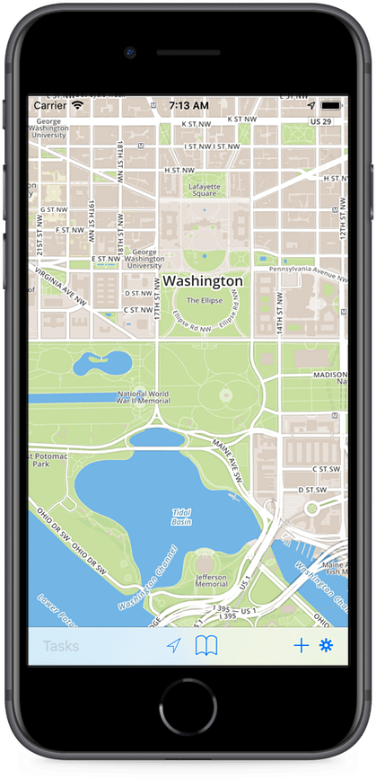
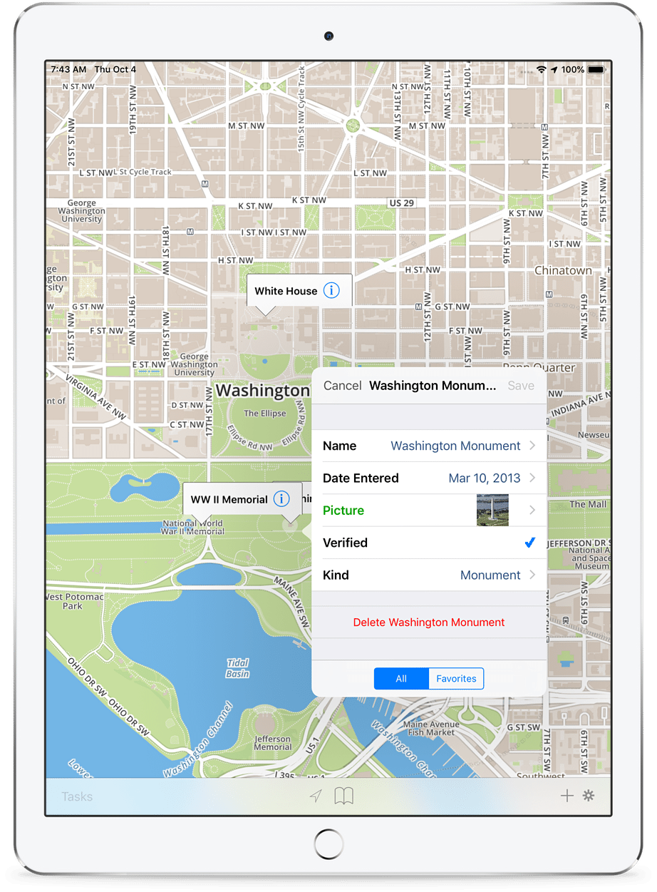
The key benefit of any mobile product is the ability to see the world directly in your vicinity. CartoMobile integrates with the GPS in the iPad and iPhone to bring your immediate world in to focus at the touch of a button. When you need a broader view, you know what to do: just pinch to zoom out.
Assisted data entry
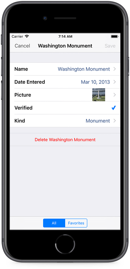
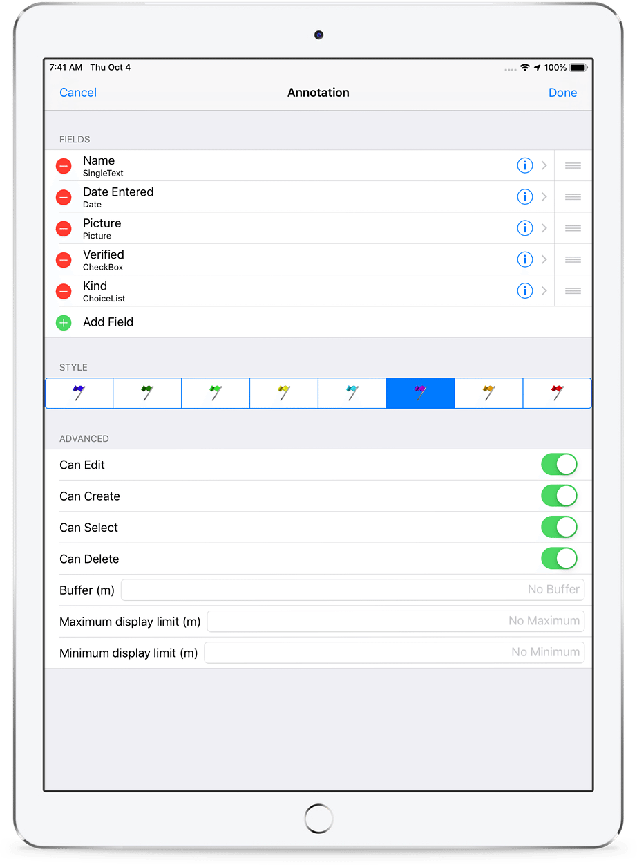
By providing an easy way for organizations to customize their data entry experience, including HTML and plain text help (yes, including pictures) as well as a wide variety of field types, CartoMobile can streamline your data collection process and make the best use of your time in the field. But, we wanted to take that one step further. When you are entering address information on CartoMobile, it can use the information it has about your surroundings to narrow down the street information to just those in your immediate vicinity and let you choose from a list, no more awkward typing for field personnel, and no more typos when bringing that data to your systems.
See it all, or just a little
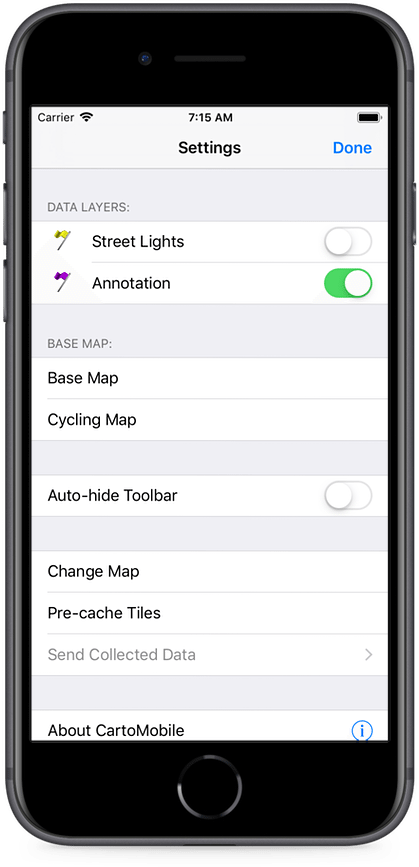
CartoMobile is ready to show your Spatial Data Infrastructure in all of its glory, or to focus on just one part, depending on your specific task and needs. By being customizable on a per-task basis and by supporting user and role-based security, it keeps data in the hands of the people who need it (literally). In the field, you can change your display to add or remove auxiliary information—getting the clutter out of the way so that you can do your work.
Keeping on task
Some mobile applications involve looking up or entering information based on your current location. CartoMobile is at home in that space, but many applications require dispatching data collectors to particular locations, so it has a Task list, updated automatically from your servers, which lists all available and pending tasks, allows direct updating, and can even display on the map or hand over the destinations to Apple's Maps program to help guide you to your destination. No more carrying a GPS device, a laptop, and a written punch list. And the folks at home base can see status updates as soon as they're entered on the iPad or iPhone.
Your data where you are
By taking full advantage of adaptive caching techniques and multicore processing (where available), users can just drop their Raster imagery and Vector data right into CartoMobile in iTunes and it will make the data available immediately. Users can add layers to one or more saved Map configurations, providing easy ways to share devices between users or share data.
Coordinate your team
CartoMobile works equally well for lone data gathering operations as multi-user situations. Although shapefiles are the most popular way to use the software, it also has extensive support for industry-standard WFS (Web Feature Servers) which can coordinate real-time data visualization and editing.
CartoMobile's configuration files are also available for sharing, making it easy to keep everyone in your group on the same page. Whether you want to put the configuration on a server, or deliver it by email, it's easy to get an additional user set up on CartoMobile.
Highly Configurable
ClueTrust also provides additional support and customization through our CartoMobile Enterprise program, through which you can receive help creating a sophisticated configuration for your environment, or if you have peculiar needs, or strict security requirements, you can acquire customized versions of the software tailored to meet your needs.
If you are interested in the more advanced features of CartoMobile, please Contact Us.